
Trump Posts Map Renaming Lake Ontario as “Lake America”
Trump shares an edited map that crosses out Ontario on Lake Ontario and writes America in red, echoing his earlier Gulf of America rebrand.

WASHINGTON D.C. — Donald J. Trump shared an edited map that reimagines Lake Ontario as “Lake America,” crossing out the body of water’s name in red ink.
The photo illustration shows a figure styled to resemble Trump, seen from behind in a dark navy suit, holding a red marker to a map of the Lake Ontario region along the United States-Canada border. The word “ONTARIO” appears struck through with a red line, and “AMERICA” is written beneath it. The map labels surrounding landmarks including Rice Lake, Sacketts Harbor, Galloo Island, Stony Island, Henderson Harbor, Rochester, Oneida Lake, Fulton, the Erie Canal and Lockport.
Here is the full post on truthsocial: “ONTARIO Rice Lake LAKE ONTARIO AMERICA ockport Erie Canal Pri PRA Sacketts Harbor Galloo Island Stony Island Henderson Harbor Roches UNITED enesee wego Oneida Lake aneadoun Fulton” on September 6, 2026 at 1:47 PM ET.
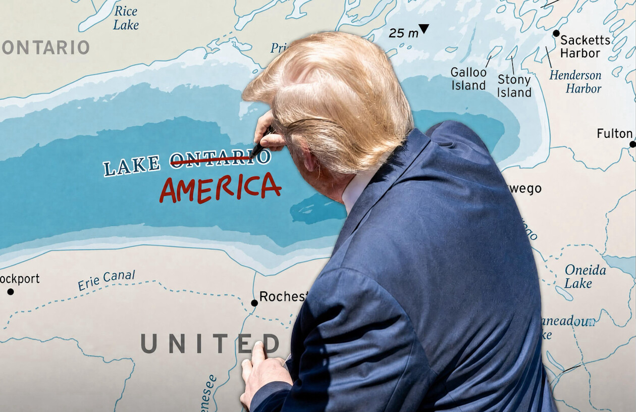

An edited map depicting Lake Ontario renamed "Lake America" is posted by President Donald J. Trump on Truth Social on 09/06/2026.
© copyright Zenger.News
This is Trump’s fourth message released today, out of five total, and the last post was one hour ago, and it is not part of a thread. On average, Trump produces 18 posts per day since his inauguration on January 20, 2025. The move fits a broader pattern in Trump’s recent messaging, with 41 of his 609 posts over the last 30 days classified as Uncategorized posts.
The map is a digitally manipulated image rather than a photograph of an event. The text on the graphic is the only content Trump attached to the post, and the caption reproduces the place names visible on the map.
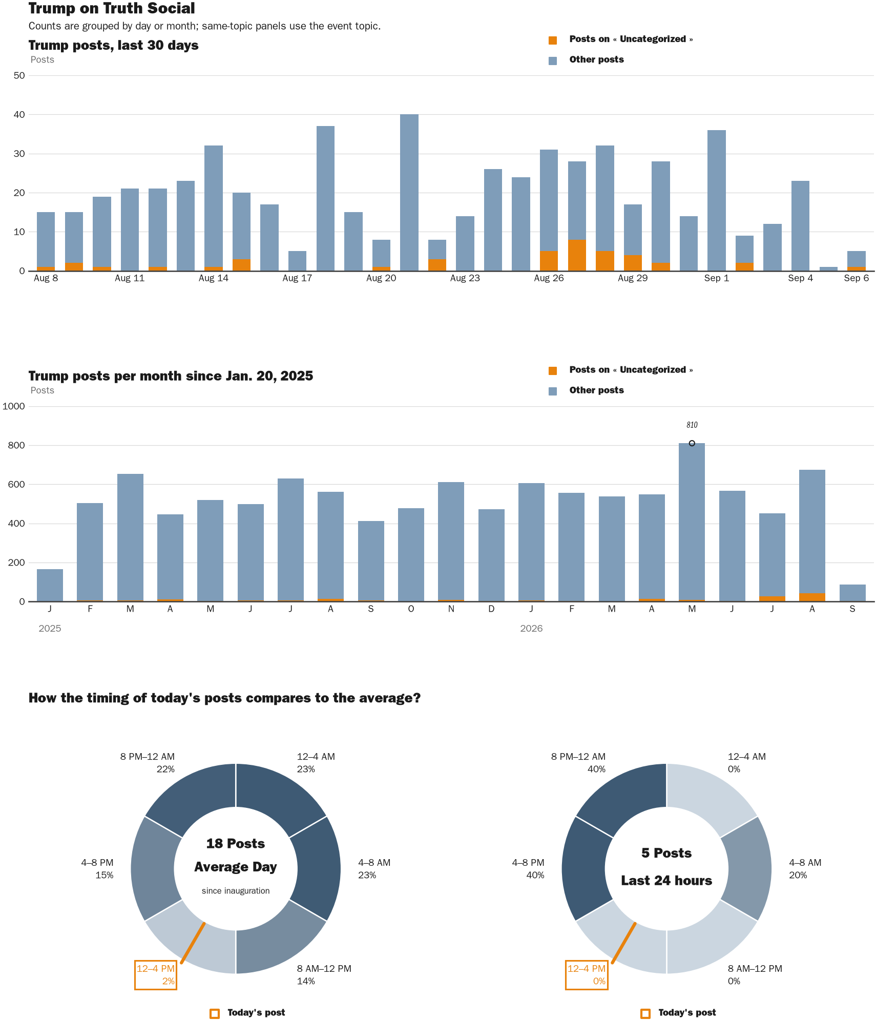
NewsFindr Chart Maker
Photo by Zenger real-time database of all Truth Social posts.
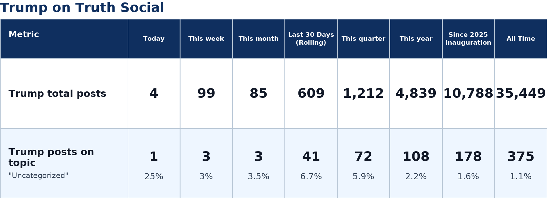
Zenger analysis
Photo by Zenger analysis
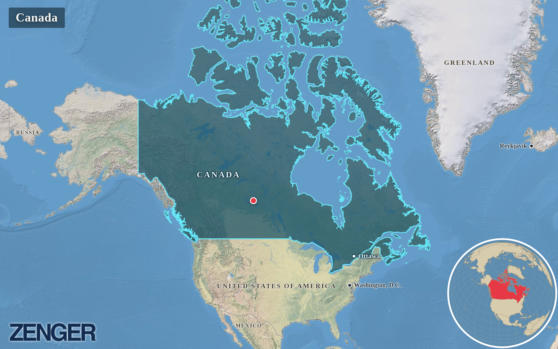
Protomaps / Natural Earth – Canada
Photo by Protomaps / Natural Earth – Canada